2021
NY1214 : The eastern end of Ennerdale Water
taken 3 years ago, 4 km SE of Croasdale, Cumbria, England
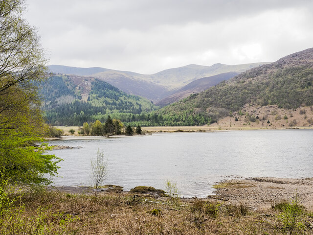
The eastern end of Ennerdale Water
The River Liza enters the lake as Char Dub behind the tree at the left side of the image.
Haycock is the mountain at the centre of the skyline.
Haycock is the mountain at the centre of the skyline.
 Map © Crown Copyright")
TIP: Click the map for more Large scale mapping
- Grid Square
- NY1214, 25 images (more nearby 🔍)
- Photographer
- Trevor Littlewood (more nearby)
- Date Taken
- Wednesday, 28 April, 2021 (more nearby)
- Submitted
- Wednesday, 5 May, 2021
- Subject Location
-
OSGB36:
 NY 1227 1436 [10m precision]
WGS84: 54:31.0149N 3:21.4041W - Camera Location
-
OSGB36: NY 1223 1464
- View Direction
- SOUTH (about 180 degrees)