2021
SP3078 : Classic bungalow, Tile Hill Lane, Whoberley, Coventry
taken 3 years ago, near to Earlsdon, Coventry, England
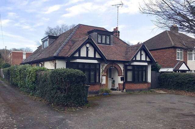
Classic bungalow, Tile Hill Lane, Whoberley, Coventry
On old-maps.co.uk housing is shown extending along the north side of Tile Hill Lane from 1914. This bungalow is first shown on a map of 1937 (as is the huge Standard Motor Works to the south). It looks as though a room has been created in the roofspace. The context is SP3078 : East end of Tile Hill Lane, Whoberley, Coventry.
 Map © Crown Copyright")
TIP: Click the map for more Large scale mapping
- Grid Square
- SP3078, 163 images (more nearby 🔍)
- Photographer
- Robin Stott (more nearby)
- Date Taken
- Monday, 8 March, 2021 (more nearby)
- Submitted
- Friday, 7 May, 2021
- Subject Location
-
OSGB36:
 SP 3081 7855 [10m precision]
WGS84: 52:24.2459N 1:32.9132W - Camera Location
-
OSGB36: SP 30804 78541
- View Direction
- North-northeast (about 22 degrees)