2021
SE1737 : Salvation Army citadel, Walter Street, Idle
taken 3 years ago, near to Shipley, Bradford, England
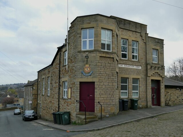
Salvation Army citadel, Walter Street, Idle
On an old map it is shown as a "barracks" which is curious because the S.A. is of course not an army in the usual sense, but a religious movement. According to their website, the building was erected in 1890 and Messrs. J Obank were the builders.
Idle & Thorp
Idle and Thorp are two formerly separate villages north of Bradford. Nowadays they form part of the Bradford conurbation, and the name of Thorp is much less used locally than Idle (although it presumably gave its name to nearby Thorpe Edge). Together, they were formerly known as Idlethorp, and that is the title of a local history book by Wright Watson published in 1950, from a facsimile copy of which (ISBN 9 781 905 40846 8) I have quoted extracts in individual photo descriptions.
 Map © Crown Copyright")
TIP: Click the map for more Large scale mapping
- Grid Square
- SE1737, 227 images (more nearby 🔍)
- Photographer
- Stephen Craven (more nearby)
- Date Taken
- Sunday, 4 April, 2021 (more nearby)
- Submitted
- Saturday, 8 May, 2021
- Subject Location
-
OSGB36:
 SE 1768 3780 [10m precision]
WGS84: 53:50.1694N 1:43.9695W - Camera Location
-
OSGB36: SE 1768 3782
- View Direction
- SOUTH (about 180 degrees)