2021
SE1737 : Thorpe Primary School (3)
taken 3 years ago, 3 km from Shipley, Bradford, England
This is 1 of 4 images, with title starting with Thorpe Primary School in this square
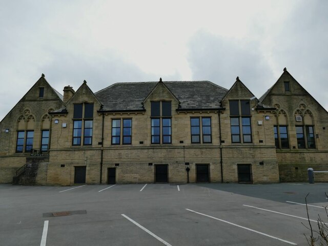
Thorpe Primary School (3)
The former National School opened in 1847, in more recent times became a Middle School and (when Bradford abandoned that system) a Primary School. The original buildings have been added to over the years. This is the view from Albion Road.
Idle & Thorp
Idle and Thorp are two formerly separate villages north of Bradford. Nowadays they form part of the Bradford conurbation, and the name of Thorp is much less used locally than Idle (although it presumably gave its name to nearby Thorpe Edge). Together, they were formerly known as Idlethorp, and that is the title of a local history book by Wright Watson published in 1950, from a facsimile copy of which (ISBN 9 781 905 40846 8) I have quoted extracts in individual photo descriptions.
 Map © Crown Copyright")
TIP: Click the map for more Large scale mapping
- Grid Square
- SE1737, 227 images (more nearby 🔍)
- Photographer
- Stephen Craven (more nearby)
- Date Taken
- Sunday, 4 April, 2021 (more nearby)
- Submitted
- Sunday, 9 May, 2021
- Subject Location
-
OSGB36:
 SE 1792 3760 [10m precision]
WGS84: 53:50.0611N 1:43.7514W - Camera Location
-
OSGB36: SE 1793 3762
- View Direction
- South-southwest (about 202 degrees)