2021
TQ0808 : Path heading ESE towards Myrtle Grove Farm
taken 3 years ago, 3 km from Patching, West Sussex, England
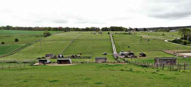
Path heading ESE towards Myrtle Grove Farm
The line of the path isn't clearly visible, but it crosses the numerous small fields and paddocks that you can see in the photo. I lost count of the number of gates I had to open and close.
 Map © Crown Copyright")
TIP: Click the map for more Large scale mapping
- Grid Square
- TQ0808, 71 images (more nearby 🔍)
- Photographer
- Ian Cunliffe (more nearby)
- Date Taken
- Thursday, 13 May, 2021 (more nearby)
- Submitted
- Thursday, 13 May, 2021
- Subject Location
-
OSGB36:
 TQ 087 088 [100m precision]
WGS84: 50:52.1524N 0:27.3711W - Camera Location
-
OSGB36: TQ 085 089
- View Direction
- East-southeast (about 112 degrees)