2004
NX5576 : Roundhouse, Clatteringshaws Loch
taken 20 years ago, 3 km from Mid Garrary, Dumfries And Galloway, Scotland
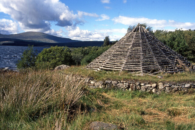
Roundhouse, Clatteringshaws Loch
A replica iron-age roundhouse. Meikle Millyea is in the distance.
 Map © Crown Copyright")
TIP: Click the map for more Large scale mapping
- Grid Square
- NX5576, 421 images (more nearby 🔍)
- Photographer
- Ian Taylor (more nearby)
- Date Taken
- Monday, 30 August, 2004 (more nearby)
- Submitted
- Monday, 17 May, 2021
- Subject Location
-
OSGB36:
 NX 5514 7641 [10m precision]
WGS84: 55:3.6586N 4:16.1798W - Camera Location
-
OSGB36: NX 5514 7640
- View Direction
- North-northwest (about 337 degrees)