2005
NN2460 : Blackwater Dam
taken 19 years ago, near to Warbrick's Loch [water Feature], Highland, Great Britain
This is 1 of 3 images, with title Blackwater Dam in this square
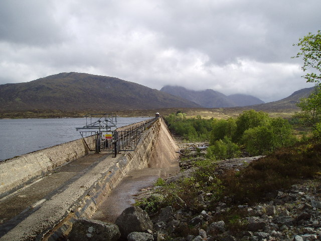
Blackwater Dam
About 2/3 of the way between Corrour Station and Kinlochleven. It took twenty minutes to cross the dam.
 Map © Crown Copyright")
TIP: Click the map for more Large scale mapping
- Grid Square
- NN2460, 22 images (more nearby 🔍)
- Photographer
- John Naisbitt (more nearby)
- Date Taken
- Thursday, 26 May, 2005 (more nearby)
- Submitted
- Friday, 21 October, 2005
- Subject Location
-
OSGB36:
 NN 2491 6071 [10m precision]
WGS84: 56:42.3101N 4:51.6999W - Camera Location
-
OSGB36: NN 2493 6078
- View Direction
- South-southwest (about 202 degrees)