2019
NY4153 : Benchmark on abutment of railway bridge CGS7/238
taken 5 years ago, near to Brisco, Cumbria, England
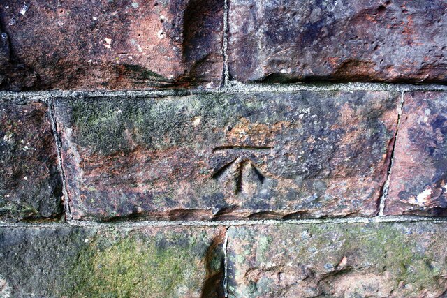
Benchmark on abutment of railway bridge CGS7/238
Ordnance Survey cut mark benchmark described on the Bench Mark Database at Link
 Map © Crown Copyright")
TIP: Click the map for more Large scale mapping
- Grid Square
- NY4153, 73 images (more nearby 🔍)
- Photographer
- Luke Shaw (more nearby)
- Date Taken
- Saturday, 24 August, 2019 (more nearby)
- Submitted
- Monday, 24 May, 2021
- Subject Location
-
OSGB36:
 NY 4136 5363 [10m precision]
WGS84: 54:52.4389N 2:54.9211W - Camera Location
-
OSGB36: NY 4136 5363
- View Direction
- North-northwest (about 337 degrees)