2021
SN3860 : Ordnance Survey Cut Mark
taken 3 years ago, near to New Quay, Ceredigion/Sir Ceredigion, Wales
This is 1 of 3 images, with title Ordnance Survey Cut Mark in this square
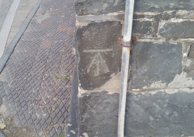
Ordnance Survey Cut Mark
This OS cut mark can be found on the Fish & Chip Shop, Church Street. It marks a point 13.683m above mean sea level.
 Map © Crown Copyright")
TIP: Click the map for more Large scale mapping
- Grid Square
- SN3860, 249 images (more nearby 🔍)
- Photographer
- Adrian Dust (more nearby)
- Date Taken
- Wednesday, 26 May, 2021 (more nearby)
- Submitted
- Thursday, 27 May, 2021
- Subject Location
-
OSGB36:
 SN 3891 6009 [10m precision]
WGS84: 52:12.9245N 4:21.5622W - Camera Location
-
OSGB36: SN 3891 6009
- View Direction
- Southwest (about 225 degrees)