2021
SE0647 : Scar Ghyll Farm on south side of Straight Lane
taken 3 years ago, near to Addingham, Bradford, England
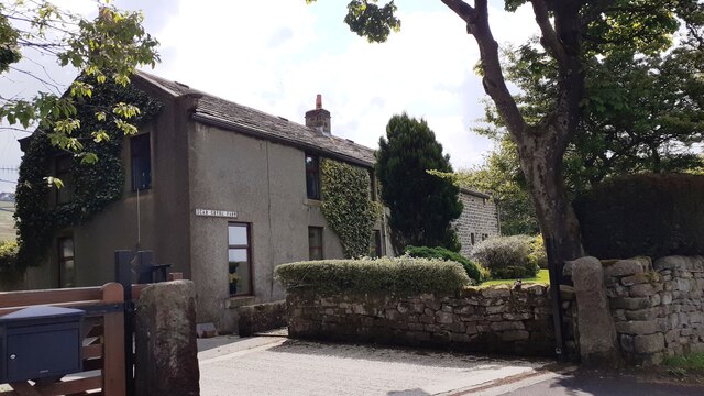
Scar Ghyll Farm on south side of Straight Lane
Ordnance Survey documents indicate that a benchmark levelled at 276.826m above Newlyn Datum was verified in 1962 on a building at the farm
 Map © Crown Copyright")
TIP: Click the map for more Large scale mapping
- Grid Square
- SE0647, 25 images (more nearby 🔍)
- Photographer
- Roger Templeman (more nearby)
- Contributed by
- Luke Shaw (more nearby)
- Date Taken
- Saturday, 29 May, 2021 (more nearby)
- Submitted
- Monday, 31 May, 2021
- Subject Location
-
OSGB36:
 SE 0690 4777 [10m precision]
WGS84: 53:55.5611N 1:53.7847W - Camera Location
-
OSGB36: SE 0692 4778
- View Direction
- Southwest (about 225 degrees)