J3773 : The Orangefield Road, Belfast
taken 16 years ago, 4 km E of Belfast, Co Antrim, Northern Ireland
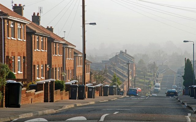
The Orangefield Road, Belfast
The long period of post-WW1 depression finally ended in the 50s. In Belfast it was particularly noticeable in the east as new factories opened and new houses were built on previously undeveloped land. The Orangefield Road is typical of the architecture of the area and the period. The view is from the North Road J3773 : The North Road, Belfast towards the Sandown Road. The traffic calming humps are a much later addition. Continue to J3773 : The Orangefield Road, Belfast (2).
![Creative Commons Licence [Some Rights Reserved]](https://s1.geograph.org.uk/img/somerights20.gif)
|
· Find out How to reuse this image ·
Share:
|
|||||
|
There is 1 post in a
discussion on J3773 (preview on the left) |
Suggest an update to this image | Contact the contributor | |||
Loading map... (JavaScript required)
- Grid Square
- J3773, 403 images (more nearby
 )
)
- Photographer
- Albert Bridge (find more nearby)
- Date Taken
- Monday, 11 February, 2008 (more nearby)
- Submitted
- Monday, 11 February, 2008
- Category
- Street (more nearby)
- Subject Location
-
Irish:
 J 373 735 [100m precision]
WGS84: 54:35.5031N 5:52.5815W - Camera Location
-
Irish: J 372 736
- View Direction
- East-southeast (about 112 degrees)
Image classification(about):
Geograph
This page has been viewed about 158 times.
View this location:
KML (Google Earth) ·
Google Maps ·
Bing Maps ·
Geograph Coverage Map ·
More Links for this image
·
Bing Maps ·
Geograph Coverage Map ·
More Links for this image