2021
SN5327 : Ordnance Survey Cut Mark
taken 3 years ago, near to Horeb, Carmarthenshire/Sir Gaerfyrddin, Wales
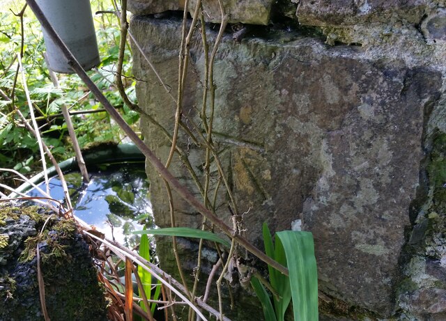
Ordnance Survey Cut Mark
This OS cut mark can be found on a building at Waun-las-onen. It marks a point 105.423m above mean sea level.
 Map © Crown Copyright")
TIP: Click the map for more Large scale mapping
- Grid Square
- SN5327, 7 images (more nearby 🔍)
- Photographer
- Adrian Dust (more nearby)
- Date Taken
- Friday, 4 June, 2021 (more nearby)
- Submitted
- Saturday, 5 June, 2021
- Subject Location
-
OSGB36:
 SN 5310 2788 [10m precision]
WGS84: 51:55.7996N 4:8.2773W - Camera Location
-
OSGB36: SN 5310 2788
- View Direction
- Southeast (about 135 degrees)