2021
SU7148 : Farmland, Upton Grey
taken 3 years ago, near to South Warnborough, Hampshire, England
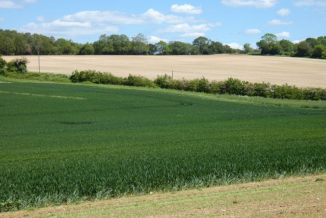
Farmland, Upton Grey
With wheat in the foreground and a crop of maize on the whiteish soil beyond Little Dean Lane.
 Map © Crown Copyright")
TIP: Click the map for more Large scale mapping
- Grid Square
- SU7148, 10 images (more nearby 🔍)
- Photographer
- Andrew Smith (more nearby)
- Date Taken
- Saturday, 5 June, 2021 (more nearby)
- Submitted
- Monday, 7 June, 2021
- Subject Location
-
OSGB36:
 SU 712 485 [100m precision]
WGS84: 51:13.9124N 0:58.8202W - Camera Location
-
OSGB36: SU 710 485
- View Direction
- EAST (about 90 degrees)