2021
SS8979 : Nant Cefn-glas, Bridgend
taken 3 years ago, near to Bridgend/Pen-y-Bont ar Ogwr, Wales
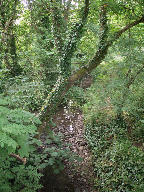
Nant Cefn-glas, Bridgend
A short tributary of the River Ogmore which, maps indicate, extends little beyond the boundary of the town. In the picture, which was taken on a small bridge at the northern end of the Broadlands Cycle Route, the stream is seen low in water during a dry spell.
 Map © Crown Copyright")
TIP: Click the map for more Large scale mapping
- Grid Square
- SS8979, 60 images (more nearby 🔍)
- Photographer
- eswales (more nearby)
- Date Taken
- Tuesday, 8 June, 2021 (more nearby)
- Submitted
- Friday, 11 June, 2021
- Subject Location
-
OSGB36:
 SS 899 794 [100m precision]
WGS84: 51:30.2049N 3:35.2172W - Camera Location
-
OSGB36: SS 899 794
- View Direction
- West-northwest (about 292 degrees)