2021
NX9958 : Anti-tank defences, Hogus Point
taken 3 years ago, near to Carsethorn, Dumfries And Galloway, Scotland
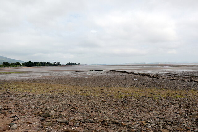
Anti-tank defences, Hogus Point
This looked to me like some kind of old fish-trap or even a flooded field boundary from the map. Canmore identifies it as anti-tank blocks from the Second World War: Link
 Map © Crown Copyright")
TIP: Click the map for more Large scale mapping
- Grid Square
- NX9958, 10 images (more nearby 🔍)
- Photographer
- Andrew Curtis (more nearby)
- Date Taken
- Friday, 2 July, 2021 (more nearby)
- Submitted
- Sunday, 4 July, 2021
- Subject Location
-
OSGB36:
 NX 9959 5891 [10m precision]
WGS84: 54:54.8857N 3:34.0745W - Camera Location
-
OSGB36: NX 99597 58835
- View Direction
- NORTH (about 0 degrees)