2021
SP4159 : Southam Road, Ladbroke
taken 3 years ago, near to Ladbroke, Warwickshire, England
This is 1 of 2 images, with title Southam Road, Ladbroke in this square
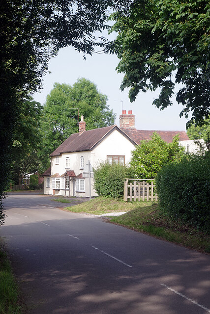
Southam Road, Ladbroke
Since Ladbroke was by-passed in 1985 this has been a quiet stretch of road serving the village itself. In this view the house ahead is called the Forge. The Ordnance Survey map of 1886 shows there to have been a smithy at this location but exactly when that ceased to be operational is not known. Today it is a residential dwelling that incorporates a separate apartment used as a holiday let.
 Map © Crown Copyright")
TIP: Click the map for more Large scale mapping
- Grid Square
- SP4159, 13 images (more nearby 🔍)
- Photographer
- Stephen McKay (more nearby)
- Date Taken
- Thursday, 1 July, 2021 (more nearby)
- Submitted
- Monday, 5 July, 2021
- Subject Location
-
OSGB36:
 SP 4177 5909 [10m precision]
WGS84: 52:13.7060N 1:23.3924W - Camera Location
-
OSGB36: SP 4173 5908
- View Direction
- EAST (about 90 degrees)