2021
TF0194 : Brown's Bridge
taken 3 years ago, near to Brandy Wharf, Lincolnshire, England
This is 1 of 4 images, with title Brown's Bridge in this square
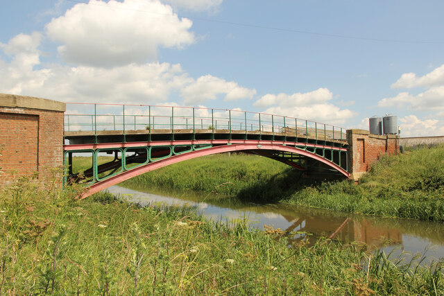
Brown's Bridge
Agricultural bridge over the River Ancholme from Snitterby Carr Lane to Carr Farm
 Map © Crown Copyright")
TIP: Click the map for more Large scale mapping
- Grid Square
- TF0194, 50 images (more nearby 🔍)
- Photographer
- Richard Croft (more nearby)
- Date Taken
- Thursday, 8 July, 2021 (more nearby)
- Submitted
- Saturday, 10 July, 2021
- Subject Location
-
OSGB36:
 TF 0191 9484 [10m precision]
WGS84: 53:26.4295N 0:28.0353W - Camera Location
-
OSGB36: TF 0190 9482
- View Direction
- North-northeast (about 22 degrees)