2021
SJ5228 : Weir Lane, Barker's Green
taken 3 years ago, near to Aston, Shropshire, England
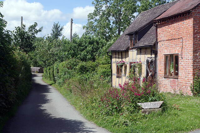
Weir Lane, Barker's Green
Weir Lane leads north-west of Barker's Green serving a handful of cottages before petering out by the River Roden. There may once have been a ford but, if so, there is no sign of it now, although a footbridge gives a route into Wem for pedestrians. The cottage in this view is called Pinhill.
 Map © Crown Copyright")
TIP: Click the map for more Large scale mapping
- Grid Square
- SJ5228, 32 images (more nearby 🔍)
- Photographer
- Stephen McKay (more nearby)
- Date Taken
- Tuesday, 6 July, 2021 (more nearby)
- Submitted
- Monday, 12 July, 2021
- Subject Location
-
OSGB36:
 SJ 5236 2841 [10m precision]
WGS84: 52:51.0641N 2:42.5322W - Camera Location
-
OSGB36: SJ 5237 2837
- View Direction
- North-northwest (about 337 degrees)