NM0447 : Tiree - Kirkapol - Carved grave slab, church of St Columba
taken 3 years ago, near to Vaul, Tiree, Argyll And Bute, Scotland
See shared descriptions below:
Kirkapol is a location on the isle of Tiree inland from Gott Bay. Lying behind the Tiree Lodge Hotel and accessed via a gate from its carpark, a grassy track leads to the ruined Kirkapol chapels and a walled graveyard.
Both buildings are ruinous, with just their walls and gables remaining. The closer (to the road and bay) is the former parish church dedicated to St Columba, dating from the C14th. It is somewhat larger than the older (C13th) chapel which sits on a small rocky mound a little further along the track. The substantial walled cemetery is to the east of the church and is considerably more recent, although it may also contain ancient graves and perhaps the remains of an ancient chapel dedicated to St Orain.
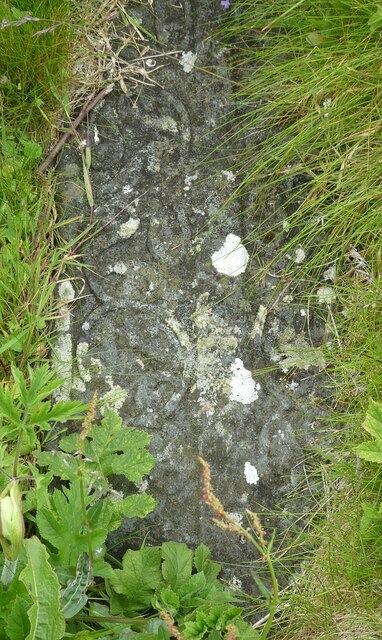
In the graveyard of the church there are a few carved grave stones, one of which is thought to perhaps be the earliest known depiction of a claymore (Scottish great sword) - though it is difficult to make out.
The Canmore and Historic Environment Scotland (HES) websites have much more information about both of the buildings:
The C13th chapel:
(Canmore) Link
(HES) Link
The C14th church:
(Canmore) Link
(HES) Link
The burial ground:
(Canmore) Link
Cladh Orain:
(Canmore) Link
There is some more general information here: Link
The island of Tiree lies in the Sea of the Hebrides to the west of the much larger island of Mull and close to its neighbouring island, Coll.
It is unlike any other major Scottish island in that it is almost flat, the majority of the island being no more than 20m above sea level. There are three hills on the western side which exceed 100m, viz Ben Hynish (141m, 462'), Beinn Hough (119m, 390' with subsidiary peak Cnoc an Fhithich 113m, 371') and Beinn Ceann Mhara (103m, 338')
From the top of Beinn Hough it is possible to see the entire island, which is only 10 miles (16km) long. Its width varies from 6¼ miles (10km) between Tràigh Chornaig in the north and Hynish in the south, to just ⅔ mile (1km) across the Vaul Golf Course between Kirkapol and Ruaig.
The island is fringed with magnificent bays and beaches with soft golden-white sands and turquoise waters. It is rather as though a small lump of Lincolnshire has been dropped in the Hebrides and then surrounded by Caribbean beaches! However, as there is no land between the west coast of the island and the continent of America, the full force of the Atlantic can batter this western coast. The result can be tremendous 'breakers' (big onshore waves) which are highly popular with surfers. Despite the permanently rather frigid sea temperatures, many people brave these waters to enjoy such activities.
The inner part of the island is given over almost entirely to farming, both arable and dairy, with Tiree cattle being sold at the small auction house near the airport.
The island's flag of a circle of golden wheat on a green background refers to this agricultural abundance.
Statistics:
Area: 7,834ha (19,358 acres, 30¼ miles²)
Population: 653 (2011 census)
Principal settlement: Scarinish (with about ¼ of the island's population)
Highest Point: Ben Hynish (141m, 462')
 Map © Crown Copyright")
- Grid Square
- NM0447, 67 images (more nearby 🔍)
- Photographer
- Rob Farrow (more nearby)
- Date Taken
- Thursday, 1 July, 2021 (more nearby)
- Submitted
- Thursday, 15 July, 2021
- Subject Location
-
OSGB36:
 NM 0424 4727 [10m precision]
WGS84: 56:31.4469N 6:48.6678W - Camera Location
-
OSGB36: NM 0424 4727
- View Direction
- SOUTH (about 180 degrees)