2021
NJ2967 : Shingle Banks
taken 3 years ago, 3 km from Lochhill, Moray, Scotland
Shingle Banks
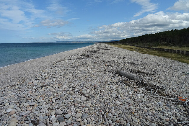
The shingle beach between the River Spey and Lossiemouth has built up so much since the end of World War II only eight decades ago that the pillboxes in the defensive line of tank traps can no longer see the sea at all.
 Map © Crown Copyright")
TIP: Click the map for more Large scale mapping
- Grid Square
- NJ2967, 29 images (more nearby 🔍)
- Photographer
- Anne Burgess (more nearby)
- Date Taken
- Saturday, 17 July, 2021 (more nearby)
- Submitted
- Saturday, 24 July, 2021
- Subject Location
-
OSGB36:
 NJ 2946 6735 [10m precision]
WGS84: 57:41.4256N 3:11.0913W - Camera Location
-
OSGB36: NJ 2937 6739
- View Direction
- East-southeast (about 112 degrees)