2021
TL5064 : Clayhithe: the Cam Conservancy quay and slipway
taken 3 years ago, near to Clayhithe, Cambridgeshire, England
This is 1 of 58 images, with title starting with Clayhithe in this square
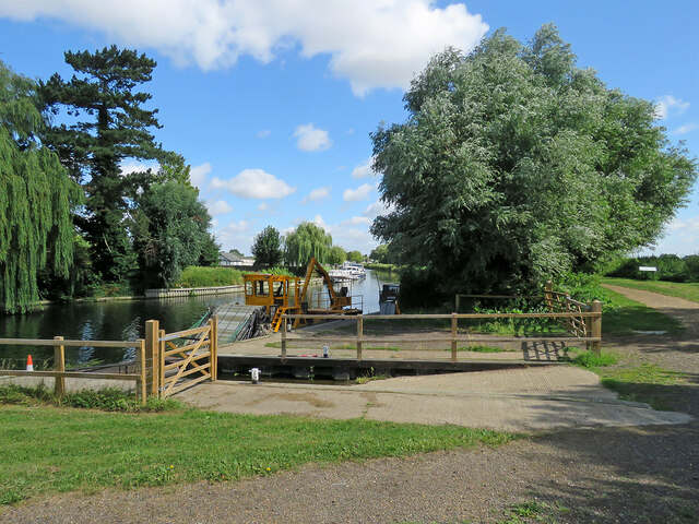
Clayhithe: the Cam Conservancy quay and slipway
Looking downstream on a fine morning in late July. The Conservancy's weed harvester is moored at the north end of the quay, in the centre of the picture. The fence and gates at the quay are recent - TL5064 : Clayhithe: downstream in early March shows how things were in 2020.
 Map © Crown Copyright")
TIP: Click the map for more Large scale mapping
- Grid Square
- TL5064, 269 images (more nearby 🔍)
- Photographer
- John Sutton (more nearby)
- Date Taken
- Thursday, 29 July, 2021 (more nearby)
- Submitted
- Thursday, 29 July, 2021
- Subject Location
-
OSGB36:
 TL 5023 6450 [10m precision]
WGS84: 52:15.4895N 0:11.9798E - Camera Location
-
OSGB36: TL 5022 6446
- View Direction
- North-northeast (about 22 degrees)