2021
NH5560 : Site of Former Quarry near Tulloch
taken 3 years ago, near to Dingwall, Highland, Scotland
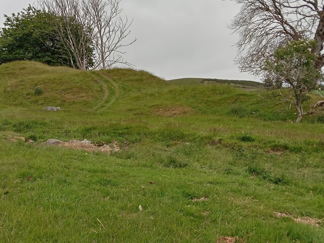
Site of Former Quarry near Tulloch
The first 1870s OS map of here shows the mound but gives no indication of what it is; the second map from about 30 years later denotes it as a former quarry. As usual with quarries, online investigations reveal next to nothing - mining and railways seem to be the internet's biggest historical concerns by far!
I recently discovered an incredibly useful old book freely available to view online. It is titled 'A Topographical History of Scotland...' and dates from 1846. Reprints are available but the original will now set you back £200 to £300. All of Scotland's larger settlements of the time are covered, often in great detail. All it mentions about quarrying in Dingwall is that there were three working quarries at the time, and all of them sandstone. This adds up as every old building in the town is built from the stuff - indeed it could be argued that Dingwall actually has its own architectural style.
I recently discovered an incredibly useful old book freely available to view online. It is titled 'A Topographical History of Scotland...' and dates from 1846. Reprints are available but the original will now set you back £200 to £300. All of Scotland's larger settlements of the time are covered, often in great detail. All it mentions about quarrying in Dingwall is that there were three working quarries at the time, and all of them sandstone. This adds up as every old building in the town is built from the stuff - indeed it could be argued that Dingwall actually has its own architectural style.
 Map © Crown Copyright")
TIP: Click the map for more Large scale mapping
- Grid Square
- NH5560, 33 images (more nearby 🔍)
- Photographer
- Ian Dodds (more nearby)
- Date Taken
- Wednesday, 30 June, 2021 (more nearby)
- Submitted
- Friday, 30 July, 2021
- Subject Location
-
OSGB36:
 NH 5515 6061 [10m precision]
WGS84: 57:36.7287N 4:25.5772W - Camera Location
-
OSGB36: NH 5515 6054
- View Direction
- NORTH (about 0 degrees)