2021
NC9823 : Pools East of Craggan Burn
taken 3 years ago, near to Creag Scalabsdale [hill or Mountain], Highland, Great Britain
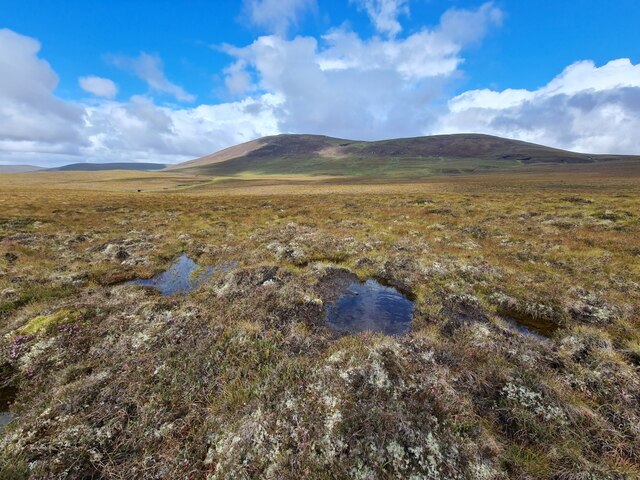
Pools East of Craggan Burn
An unusually wet area of the moorland. In the distance is Creag Scalabsdale. The burn that the area drains into seems to be spelled with one "g" on some maps earlier than the 2021 edition of OS 1:25000.
 Map © Crown Copyright")
TIP: Click the map for more Large scale mapping
- Grid Square
- NC9823, 4 images (more nearby 🔍)
- Photographer
- Thomas Byrd (more nearby)
- Date Taken
- Saturday, 14 August, 2021 (more nearby)
- Submitted
- Sunday, 15 August, 2021
- Subject Location
-
OSGB36:
 NC 9882 2353 [10m precision]
WGS84: 58:11.3371N 3:43.3545W - Camera Location
-
OSGB36: NC 98880 23512
- View Direction
- West-northwest (about 292 degrees)