J3873 : Development site, Knock, Belfast
taken 16 years ago, 3 km from Dundonald, Co Down, Northern Ireland
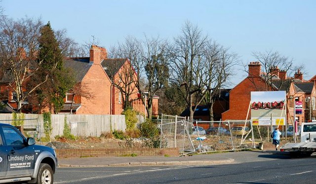
Development site, Knock, Belfast
This land at the corner of Ormiston Drive (left) and the Upper Newtownards Road was previously occupied by a petrol station. Now a site for new townhouses.
No 484 Upper Newtownards Road, Belfast
A vacant site, between Ormiston Drive and Ormiston Park, once occupied by a Texaco petrol station. There have been several redevelopment proposals over the years. The current (February 2016) is 7 October 2014 Z/2014/1341/F Residential development comprising 4no detached dwellings (amended plans) 484 Upper Newtownards Road BT4 3GZ. The photographs submitted by me appear as a matter of record only. I have no connection with any of the parties involved and express no opinion about the application for planning permission.
![Creative Commons Licence [Some Rights Reserved]](https://s1.geograph.org.uk/img/somerights20.gif)
|
· Find out How to reuse this image ·
Share:
|
|||||
| Start a discussion on J3873 | Suggest an update to this image | Contact the contributor | |||
Loading map... (JavaScript required)
- Grid Square
- J3873, 198 images (more nearby
 )
)
- Photographer
- Albert Bridge (find more nearby)
- Date Taken
- Monday, 18 February, 2008 (more nearby)
- Submitted
- Monday, 18 February, 2008
- Category
- Land > Vacant sites (more nearby)
- Subject Location
-
Irish:
 J 385 739 [100m precision]
WGS84: 54:35.6831N 5:51.4766W - Camera Location
-
Irish: J 384 739
- View Direction
- East-northeast (about 67 degrees)
Image classification(about):
Geograph (Second Visitor for J3873)
This page has been viewed about 133 times.
View this location:
KML (Google Earth) ·
Google Maps ·
Bing Maps ·
Geograph Coverage Map ·
More Links for this image
·
Bing Maps ·
Geograph Coverage Map ·
More Links for this image