2021
NF8366 : Loch a' Bharpa
taken 3 years ago, 3 km from Locheport, North Uist & Berneray, Na h-Eileanan an Iar, Scotland
This is 1 of 3 images, with title Loch a' Bharpa in this square
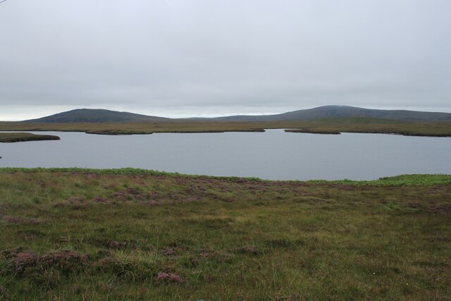
Loch a' Bharpa
Photo taken with the heather in bloom around the loch from below the power lines that run parallel to the A867 road. South of the road is the burial cairn of Barpa Langass.
 Map © Crown Copyright")
TIP: Click the map for more Large scale mapping
- Grid Square
- NF8366, 3 images (more nearby 🔍)
- Photographer
- Alan Pickup (more nearby)
- Date Taken
- Wednesday, 25 August, 2021 (more nearby)
- Submitted
- Saturday, 28 August, 2021
- Subject Location
-
OSGB36:
 NF 8365 6637 [10m precision]
WGS84: 57:34.5710N 7:17.6589W - Camera Location
-
OSGB36: NF 8393 6605
- View Direction
- Northwest (about 315 degrees)