2021
TF3937 : Close up of the training wall
taken 3 years ago, 4 km S of Scrane End, Lincolnshire, England
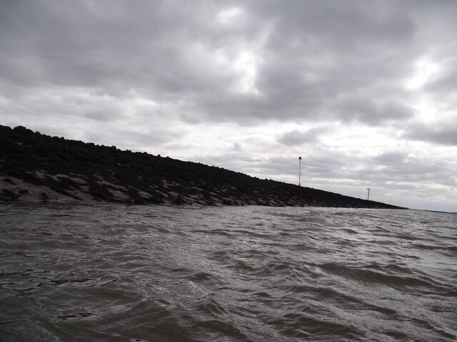
Close up of the training wall
The training wall runs either side of the River Welland, with occasional breaks to the drainage system and numerous creek inlets. Navigation poles line the route as it is difficult to discern the wall when it is below sea level. Behind the wall lies Herring Hill. Compare with the photo referred to below.
Having previously attempted a geograph of this gridsquare almost 12 years ago from the Boston Belle TF3937 : Edge of the marsh, I finally managed to photograph it at a much lower level of tide, from Bluey Due which being much smaller than the Boston Belle, could sail much closer to the wall itself. See link for youTube excerpts of the trip Link .
.
Having previously attempted a geograph of this gridsquare almost 12 years ago from the Boston Belle TF3937 : Edge of the marsh, I finally managed to photograph it at a much lower level of tide, from Bluey Due which being much smaller than the Boston Belle, could sail much closer to the wall itself. See link for youTube excerpts of the trip Link
 Map © Crown Copyright")
TIP: Click the map for more Large scale mapping
- Grid Square
- TF3937, 3 images (more nearby 🔍)
- Photographer
- Ian Paterson (more nearby)
- Date Taken
- Sunday, 29 August, 2021 (more nearby)
- Submitted
- Monday, 30 August, 2021
- Subject Location
-
OSGB36:
 TF 3901 3796 [10m precision]
WGS84: 52:55.2644N 0:3.9726E - Camera Location
-
OSGB36: TF 39021 37982
- View Direction
- South-southwest (about 202 degrees)