2021
SD7895 : Barn in field on east side of B6259 at junction with footpath to How Beck Bridge
taken 3 years ago, 3 km from Grisedale, Cumbria, England
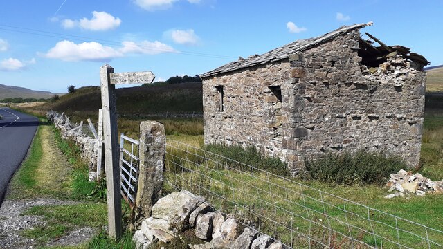
Barn in field on east side of B6259 at junction with footpath to How Beck Bridge
The barn is now losing its roof: compare with 2013 photo SD7895 : Barn beside B6259 opposite White Birch Cottage
 Map © Crown Copyright")
TIP: Click the map for more Large scale mapping
- Grid Square
- SD7895, 50 images (more nearby 🔍)
- Photographer
- Luke Shaw (more nearby)
- Date Taken
- Saturday, 28 August, 2021 (more nearby)
- Submitted
- Friday, 3 September, 2021
- Subject Location
-
OSGB36:
 SD 7811 9584 [10m precision]
WGS84: 54:21.4568N 2:20.3001W - Camera Location
-
OSGB36: SD 7810 9582
- View Direction
- North-northeast (about 22 degrees)