2021
SN8433 : Llwybr ceffyl i Flaen y Cwm / Path to Blaen y Cwm
taken 3 years ago, near to Halfway, Carmarthenshire/Sir Gaerfyrddin, Wales
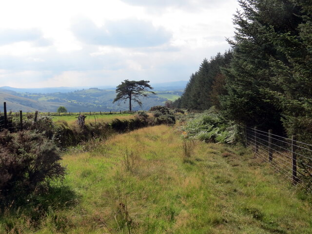
Llwybr ceffyl i Flaen y Cwm / Path to Blaen y Cwm
Llwybr ceffyl yn mynd i lawr y waered i gyfeiriad Blaen y Cwm (adfail).
Bridleway descending towards the ruined Blaen y Cwm (trans. head of the valley).
Bridleway descending towards the ruined Blaen y Cwm (trans. head of the valley).
 Map © Crown Copyright")
TIP: Click the map for more Large scale mapping
- Grid Square
- SN8433, 5 images (more nearby 🔍)
- Photographer
- Alan Richards (more nearby)
- Date Taken
- Wednesday, 15 September, 2021 (more nearby)
- Submitted
- Wednesday, 15 September, 2021
- Subject Location
-
OSGB36:
 SN 8485 3327 [10m precision]
WGS84: 51:59.1548N 3:40.6937W - Camera Location
-
OSGB36: SN 8491 3329
- View Direction
- West-southwest (about 247 degrees)