2021
NY9453 : Trig point at Warlaw Pike
taken 3 years ago, 4 km NNW of Baybridge, Northumberland, England
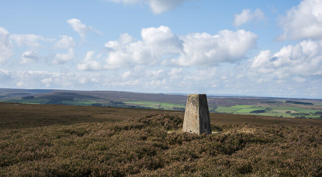
Trig point at Warlaw Pike
The trig point at Warlaw Pike at 402 m.; it lies to the north of the local high point on Bulbeck Common at 413 m.
The view beyond is to the west, across the valley of Devil's Water.
The view beyond is to the west, across the valley of Devil's Water.
 Map © Crown Copyright")
TIP: Click the map for more Large scale mapping
- Grid Square
- NY9453, 64 images (more nearby 🔍)
- Photographer
- Trevor Littlewood (more nearby)
- Date Taken
- Sunday, 26 September, 2021 (more nearby)
- Submitted
- Sunday, 26 September, 2021
- Subject Location
-
OSGB36:
 NY 9457 5346 [10m precision]
WGS84: 54:52.5524N 2:5.1690W - Camera Location
-
OSGB36: NY 9458 5347
- View Direction
- WEST (about 270 degrees)