2021
NT8816 : Buttroads Sike in the Uswayford plantation
taken 3 years ago, near to Usway Burn [water Feature], Northumberland, Great Britain
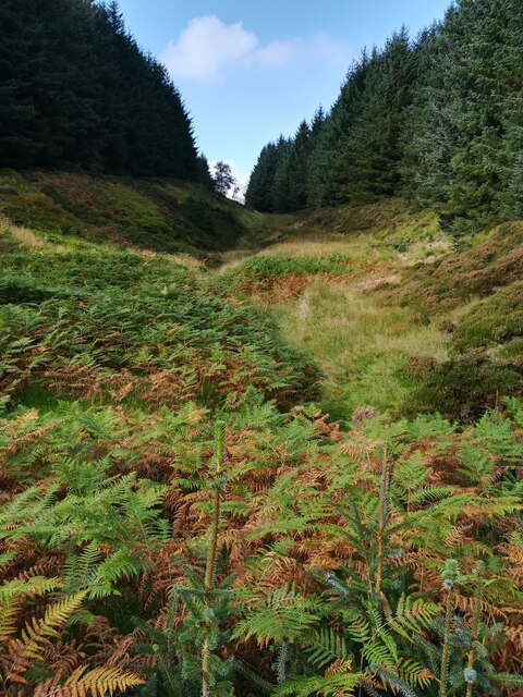
Buttroads Sike in the Uswayford plantation
Autumn approaching in this dense plantation. There are breaks where there is a stream though, known locally as sikes. Buttroads was one of the minor droving routes crossing the border ridge and dropping onto Randy's Gap on the Scottish side.
 Map © Crown Copyright")
TIP: Click the map for more Large scale mapping
- Grid Square
- NT8816, 21 images (more nearby 🔍)
- Photographer
- Steve Revell (more nearby)
- Date Taken
- Sunday, 26 September, 2021 (more nearby)
- Submitted
- Monday, 27 September, 2021
- Subject Location
-
OSGB36:
 NT 8831 1670 [10m precision]
WGS84: 55:26.6419N 2:11.1804W - Camera Location
-
OSGB36: NT 8838 1663
- View Direction
- Northwest (about 315 degrees)