2021
SN6688 : Parting of the ways on Braich Garw
taken 3 years ago, near to Tal-y-Bont, Ceredigion/Sir Ceredigion, Wales
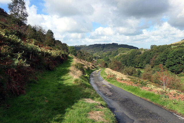
Parting of the ways on Braich Garw
The metalled road leads down to Talybont and also forms part of the Borth to Devil's Bridge Trail. To the left is a right of way leading to Caer Lletty-llwyd. This area is access land.
 Map © Crown Copyright")
TIP: Click the map for more Large scale mapping
- Grid Square
- SN6688, 8 images (more nearby 🔍)
- Photographer
- John Lucas (more nearby)
- Date Taken
- Wednesday, 29 September, 2021 (more nearby)
- Submitted
- Thursday, 30 September, 2021
- Subject Location
-
OSGB36:
 SN 6645 8867 [10m precision]
WGS84: 52:28.7739N 3:58.0747W - Camera Location
-
OSGB36: SN 66501 88659
- View Direction
- West-northwest (about 292 degrees)