2021
NR8456 : Kintyre Way
taken 3 years ago, 3 km from Glenreasdell Mains, Argyll And Bute, Scotland
This is 1 of 3 images, with title Kintyre Way in this square
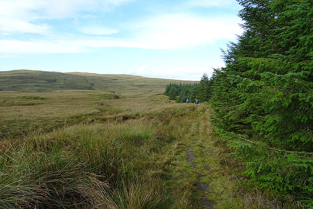
Kintyre Way
The track skirts a forest plantation, and has become much more indistinct, but it still easy to follow.
 Map © Crown Copyright")
TIP: Click the map for more Large scale mapping
- Grid Square
- NR8456, 7 images (more nearby 🔍)
- Photographer
- Anne Burgess (more nearby)
- Date Taken
- Tuesday, 28 September, 2021 (more nearby)
- Submitted
- Monday, 4 October, 2021
- Subject Location
-
OSGB36:
 NR 8421 5658 [10m precision]
WGS84: 55:45.2599N 5:26.4242W - Camera Location
-
OSGB36: NR 8435 5651
- View Direction
- West-northwest (about 292 degrees)