2021
NY2616 : Rock outcrops on Brund Fell
taken 3 years ago, near to Watendlath, Cumbria, England
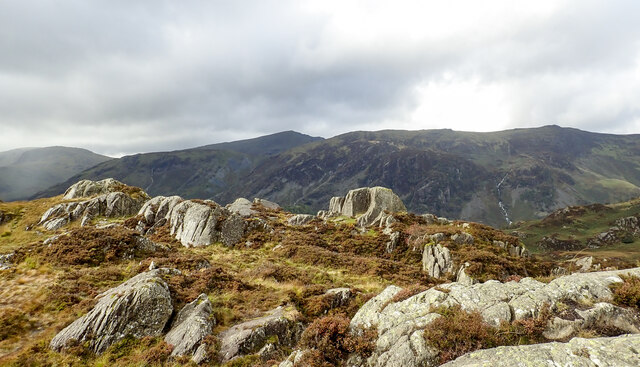
Rock outcrops on Brund Fell
Multiple rock outcrops to the west of the summit area of Brund Fell which is the highest area of Grange Fell.
In the distance the pointed hill near to the centre of the image is Dale Head; nearer and to the right of it, is High Spy.
In the distance the pointed hill near to the centre of the image is Dale Head; nearer and to the right of it, is High Spy.
 Map © Crown Copyright")
TIP: Click the map for more Large scale mapping
- Grid Square
- NY2616, 41 images (more nearby 🔍)
- Photographer
- Trevor Littlewood (more nearby)
- Date Taken
- Sunday, 3 October, 2021 (more nearby)
- Submitted
- Monday, 4 October, 2021
- Subject Location
-
OSGB36:
 NY 2636 1623 [10m precision]
WGS84: 54:32.1578N 3:8.3758W - Camera Location
-
OSGB36: NY 2641 1624
- View Direction
- WEST (about 270 degrees)