ND3883 : Swona Lighthouse
taken 3 years ago, near to West Wini Skerry [other Features], Orkney Islands, Great Britain
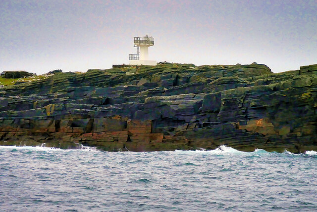
Swona is the more northerly of two islands in the Pentland Firth between the Orkney Islands and Caithness on the Scottish mainland. It lies in the southern approach to Scapa Flow, west of South Ronaldsay. It is administered as part of the Orkney Islands, while Stroma, to the south, is part of the Highland Region (although traditionally part of Caithness). There is no regular access to the island, however, the Pentland Ferries sailing between Gills Bay, near John o' Groats, and St Margaret's Hope usually passes close to the island, dependent on the tidal direction at the time.
Swona is about 1¼ miles long by about ½ mile wide. It is made up of Old Red Sandstone with cliffs on the east coast. There are prehistoric, pre-Norse and Norse remains on the island but it has been uninhabited since 1975. The island is part of the Pentland Firth Islands Site of Special Scientific Interest (SSSI) and is home to thousands of breeding seabirds, including a colony of Arctic tern on the northern part of the island, and Atlantic puffin which burrow into the hillside.
 Map © Crown Copyright")
- Grid Square
- ND3883, 19 images (more nearby 🔍)
- Photographer
- David Dixon (more nearby)
- Date Taken
- Monday, 27 September, 2021 (more nearby)
- Submitted
- Wednesday, 6 October, 2021
- Subject Location
-
OSGB36:
 ND 381 838 [100m precision]
WGS84: 58:44.2453N 3:4.2291W - Camera Location
-
OSGB36: ND 377 841
- View Direction
- Southeast (about 135 degrees)