2021
ST5974 : Ordnance Survey Rivet
taken 3 years ago, near to Redland, Bristol, England
This is 1 of 3 images, with title Ordnance Survey Rivet in this square
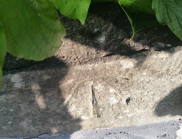
Ordnance Survey Rivet
This OS rivet can be found on the Park wall NE side of Leopold Road. It marks a point 54.763m above mean sea level.
 Map © Crown Copyright")
TIP: Click the map for more Large scale mapping
- Grid Square
- ST5974, 309 images (more nearby 🔍)
- Photographer
- Adrian Dust (more nearby)
- Date Taken
- Saturday, 9 October, 2021 (more nearby)
- Submitted
- Saturday, 9 October, 2021
- Subject Location
-
OSGB36:
 ST 5931 7491 [10m precision]
WGS84: 51:28.3009N 2:35.2330W - Camera Location
-
OSGB36: ST 5931 7491
- View Direction
- NORTH (about 0 degrees)