2021
NS5579 : Old mill lade
taken 3 years ago, near to Blanefield, Stirling, Scotland
This is 1 of 2 images, with title Old mill lade in this square
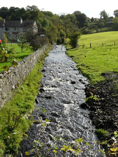
Old mill lade
This lade brings water from the Mill Dam (about 500m to the south). The water originally fed Milndavie Mill (a corn mill, but also a sawmill from the 1870s). It flows into the Blane Water just behind the photographer.
 Map © Crown Copyright")
TIP: Click the map for more Large scale mapping
- Grid Square
- NS5579, 136 images (more nearby 🔍)
- Photographer
- Richard Sutcliffe (more nearby)
- Date Taken
- Sunday, 10 October, 2021 (more nearby)
- Submitted
- Monday, 11 October, 2021
- Subject Location
-
OSGB36:
 NS 5590 7923 [10m precision]
WGS84: 55:59.0604N 4:18.6778W - Camera Location
-
OSGB36: NS 5589 7927
- View Direction
- South-southeast (about 157 degrees)