2021
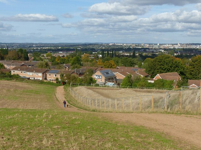
SK5835 : Wilford Hill
taken 3 years ago, near to Edwalton, Nottinghamshire, England
This is 1 of 2 images, with title Wilford Hill in this square
Wilford Hill
Recreating this 'First' for the square Link .
The alignment of the path has changed as a result of the land on the right having been earmarked for housing development.
The alignment of the path has changed as a result of the land on the right having been earmarked for housing development.
 Map © Crown Copyright")
TIP: Click the map for more Large scale mapping
- Grid Square
- SK5835, 53 images (more nearby 🔍)
- Photographer
- Alan Murray-Rust (more nearby)
- Date Taken
- Sunday, 10 October, 2021 (more nearby)
- Submitted
- Tuesday, 12 October, 2021
- Subject Location
-
OSGB36:
 SK 5835 3534 [10m precision]
WGS84: 52:54.7396N 1:8.0253W - Camera Location
-
OSGB36: SK 5841 3523
- View Direction
- North-northwest (about 337 degrees)