2021
SO7905 : Boundary Stone, Stroudwater
taken 3 years ago, near to Stonehouse, Gloucestershire, England
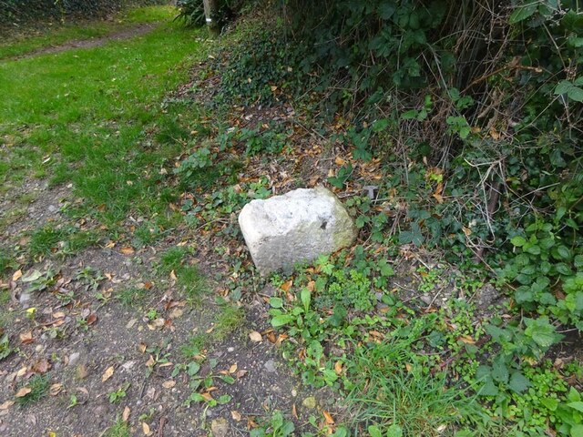
Boundary Stone, Stroudwater
To the right of the track down to Bonds Mill Cottages. Defining the limit of jurisdiction of the canal (aka navigation). If it had once had an inscription it would have been S W N.
Milestone Society National ID: GL_STWSTO01em
Milestone Society National ID: GL_STWSTO01em
National Survey of Wayside Features by The Milestone Society
These images are from Link
 Map © Crown Copyright")
TIP: Click the map for more Large scale mapping
- Grid Square
- SO7905, 208 images (more nearby 🔍)
- Photographer
- Mr Red (more nearby)
- Date Taken
- Thursday, 14 October, 2021 (more nearby)
- Submitted
- Thursday, 14 October, 2021
- Subject Location
-
OSGB36:
 SO 79204 05325 [1m precision]
WGS84: 51:44.7740N 2:18.1571W - Camera Location
-
OSGB36: SO 79204 05325
- View Direction
- Southwest (about 225 degrees)