2021
NN8302 : Recumbent stone, Sheriffmuir
taken 3 years ago, 4 km SSE of Balhaldie, Stirling, Scotland
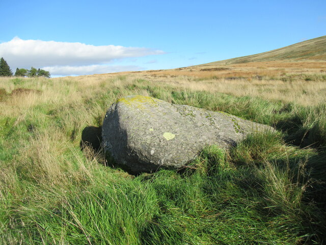
Recumbent stone, Sheriffmuir
This is the furthest north-east of the row of stones marked on the map, which run diagonally from south-west to north-east. It is likely that it once stood on its end, like the Wallace Stone, which stands nearby.
 Map © Crown Copyright")
TIP: Click the map for more Large scale mapping
- Grid Square
- NN8302, 21 images (more nearby 🔍)
- Photographer
- Alan O'Dowd (more nearby)
- Date Taken
- Friday, 15 October, 2021 (more nearby)
- Submitted
- Saturday, 16 October, 2021
- Subject Location
-
OSGB36:
 NN 8331 0233 [10m precision]
WGS84: 56:11.9534N 3:52.9407W - Camera Location
-
OSGB36: NN 8329 0233
- View Direction
- East-northeast (about 67 degrees)