Geograph - photograph every grid square
2021
SE6151
: Melrosegate Bridge
taken
3 years ago
,
near
to
York
, England
This is 1 of
4 images, with title Melrosegate Bridge
in this square
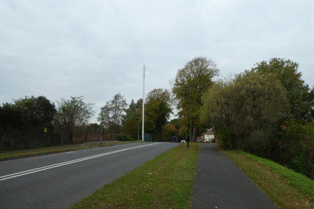
Melrosegate Bridge
The former railway bridge now crossing over a cycle path.
© Copyright
DS Pugh
and licensed for
reuse
under this
Creative Commons Licence
.
Licensing
Download
More Sizes
Share...
Share this photo via Twitter
Share this photo via Facebook
Share this photo via Pinterest
Share this photo via Flipboard
Share this photo via email/e-card
Grab a Stamped/Watermarked Image
Mark
👍🏻
Like Image
👍🏻
Like Description
Update Information
Contact Contributor
Geographical Context:
Roads, Road transport
Primary Subject:
Bridge
This photo is linked from:
Automatic Clusters
: ·
Bridge [14]
Title Clusters
: ·
Melrosegate Bridge [4]
·
TIP: Click the map for more Large scale mapping
Grid Square
SE6151
, 549 images (
more nearby
🔍
)
Photographer
DS Pugh
(
more nearby
)
Date Taken
Saturday, 16 October, 2021 (
more nearby
)
Submitted
Monday, 18 October, 2021
Subject Location
OSGB36:
SE 6194 5191
[10m precision]
WGS84:
53:57.5746N
1:3.4490W
Camera Location
OSGB36:
SE 61943 51885
View Direction
North-northeast (about 22 degrees)
NW
N
NE
W
Go
E
SW
S
SE
View Discussion for SE6151
View this location on ...
Geograph Coverage Map (includes OSM etc)
Geograph Links Page
Open in Google Maps
Navigate to location with Google Maps
Open in Google Earth Pro
Open in Google Earth for Web
Open in Bing Maps
Navigate with Google Maps
Lookup nearest Postcode
Image Type
(about)
:
geograph
This page has been
viewed
about
13
times
☰
Home
View
Search
Marked Images
Maps
Browser
Explore
Showcase
New Images
Collections
Interact
Games
Discussions
Blog
Contributors
Submit
Statistics
Leaderboards
General
FAQ
Help Pages
Sitemap
Contact Us
Support Us
sponsored by
Discussion on SE6151
SE6151 : Walmgate Bar
SE6151 : Walmgate Bar, York
The barbican at Walmgate Bar was rebuilt in 1648, having been nearly demolished in 1644 by a 'Parliament' battery on Lamel Hill (Heslington Road) during an 18-week siege of York. See
http://en.wikipedia.org/wiki/Lamel_Hill
.
🔍
What to search:
Photos
Enter keywords or a location/postcode to search nearby images
Photos near SE6151
Enter a Grid Reference
Placenames
Collections
Website Pages
Everything
Others:
Advanced Search
|
Image Browser
Or:
Coverage Map
|
Searchable Map
You are not logged in
login
|
register