2021
SD9688 : Gate in wall across track on Thornton Rust Moor
taken 3 years ago, near to Thornton Rust, North Yorkshire, England
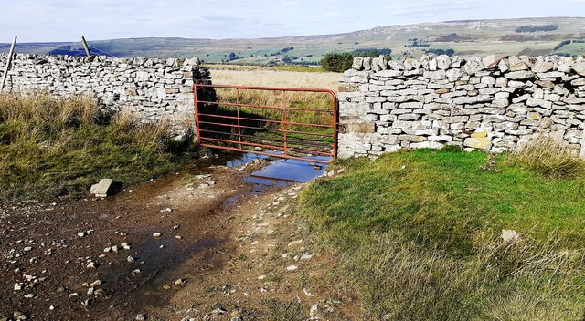
Gate in wall across track on Thornton Rust Moor
Ordnance Survey records indicate that a benchmark levelled at 347.423m above Newlyn Datum was verified in 1954 on the wall on the left hand side of the gate
 Map © Crown Copyright")
TIP: Click the map for more Large scale mapping
- Grid Square
- SD9688, 18 images (more nearby 🔍)
- Photographer
- Roger Templeman (more nearby)
- Date Taken
- Friday, 8 October, 2021 (more nearby)
- Submitted
- Monday, 18 October, 2021
- Subject Location
-
OSGB36:
 SD 9651 8816 [10m precision]
WGS84: 54:17.3433N 2:3.3069W - Camera Location
-
OSGB36: SD 9652 8813
- View Direction
- North-northwest (about 337 degrees)