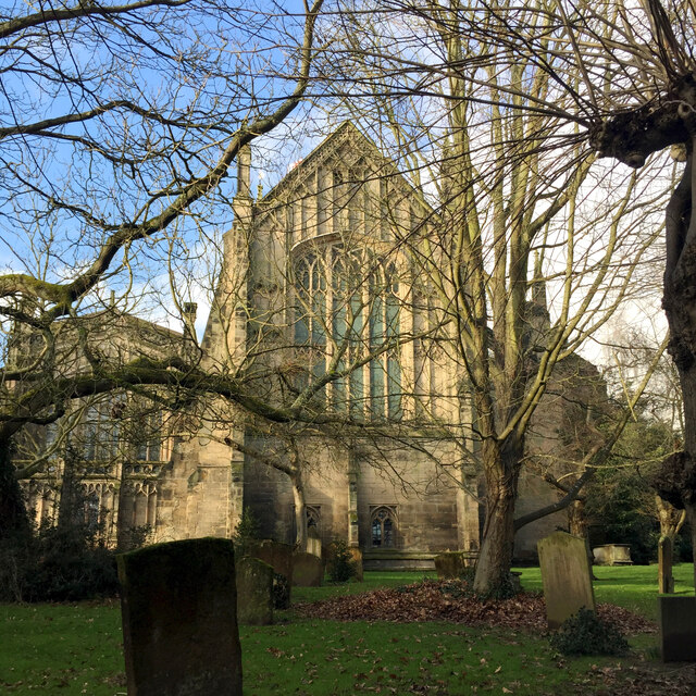
SP2864 : East window of St Mary's Church, Warwick
taken 3 years ago, near to Warwick, Warwickshire, England
Warwick is among the smallest of Britain's county towns. Had it not been for the Great Fire of Warwick in 1694, the centre of the town today might look like Stratford-upon-Avon or Henley-in-Arden with their abundant black-and-white timber-framed buildings. The fire began in a baker's shop (as did the Great Fire of London) and spread rapidly. It caused damage estimated at £90,000 and made 250 families homeless. In the Georgian period the centre of the town was rebuilt in brick and stone; some street lines were altered. Old Square, for example, was laid out to provide a better approach and setting for St Mary's Church. Further changes were brought about by the extension of Warwick Castle gardens.
Much of St Mary's Church had been destroyed in the Great Fire. Completed around 1394 it succeeded a Norman foundation which in all likelihood replaced a Saxon church. After the fire St Mary's was rebuilt in stone quarried from the churchyard although the planned tower, showing early signs of failure, was rebuilt to the west in a harder sandstone from nearby Shrewley. The siting creates a focal point in the views down Northgate Street and up Church Street. The church was completed by 1706, a light and lofty Georgian interpretation of the mediaeval style. The tower at 53 metres high (174 feet) is both a landmark and a fine viewpoint.
 Map © Crown Copyright")
- Grid Square
- SP2864, 1357 images (more nearby 🔍)
- Photographer
- Robin Stott (more nearby)
- Date Taken
- Thursday, 21 January, 2021 (more nearby)
- Submitted
- Wednesday, 20 October, 2021
- Subject Location
-
OSGB36:
 SP 2822 6498 [10m precision]
WGS84: 52:16.9346N 1:35.2655W - Camera Location
-
OSGB36: SP 2825 6498
- View Direction
- WEST (about 270 degrees)