2021
SE2836 : Meanwood, Monkbridge Road
taken 3 years ago, near to Headingley, Leeds, England
This is 1 of 5 images, with title Meanwood, Monkbridge Road in this square
Meanwood, Monkbridge Road
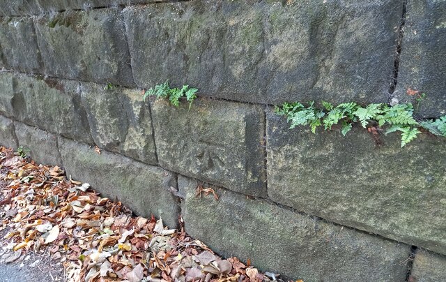
This roadside wall is on the south side of Monkbridge Road and is the boundary wall to number 18. The benchmark is cut into the 2nd course of stone and remains in very good condition.
 Map © Crown Copyright")
TIP: Click the map for more Large scale mapping
- Grid Square
- SE2836, 345 images (more nearby 🔍)
- Photographer
- Mel Towler (more nearby)
- Date Taken
- Saturday, 18 September, 2021 (more nearby)
- Submitted
- Friday, 22 October, 2021
- Subject Location
-
OSGB36:
 SE 2823 3670 [10m precision]
WGS84: 53:49.5484N 1:34.3569W - Camera Location
-
OSGB36: SE 2823 3670
- View Direction
- South-southwest (about 202 degrees)