2021
NY4253 : Manhole cover on pavement at junction of Farbrow Road and High Green Croft
taken 2 years ago, near to Carleton, Cumbria, England
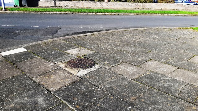
Manhole cover on pavement at junction of Farbrow Road and High Green Croft
Ordnance Survey records indicate that a benchmark levelled at 46.130m above Newlyn Datum was verified in 1972 on the concrete surround of the manhole cover
 Map © Crown Copyright")
TIP: Click the map for more Large scale mapping
- Grid Square
- NY4253, 45 images (more nearby 🔍)
- Photographer
- Roger Templeman (more nearby)
- Date Taken
- Thursday, 21 October, 2021 (more nearby)
- Submitted
- Saturday, 23 October, 2021
- Subject Location
-
OSGB36:
 NY 4266 5344 [10m precision]
WGS84: 54:52.3455N 2:53.7035W - Camera Location
-
OSGB36: NY 4267 5342
- View Direction
- North-northwest (about 337 degrees)