SD3040 : Promenade along the clifftop, Bispham, near Blackpool
taken 3 years ago, near to Bispham, Blackpool, England
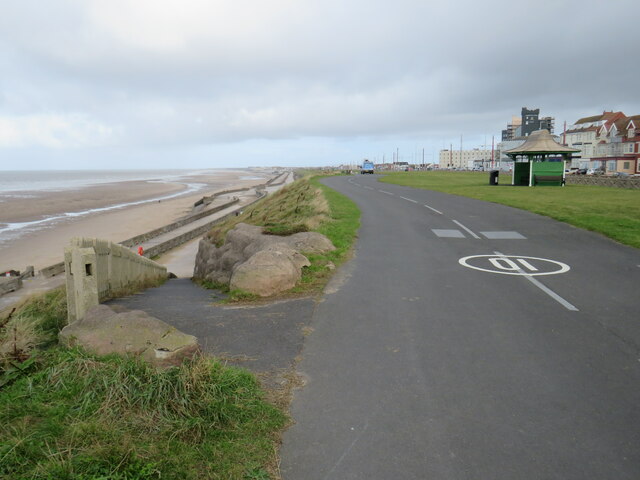
The promenade forms part of the route of National Cycle Network route 62.
Route 62 of the national Cycle Network stretches for more than 200 miles, from Fleetwood on the Fylde Coast to Selby in North Yorkshire.
From Fleetwood it runs south along the coastline through Blackpool, turns inland to cross the River Ribble at Preston, then returns to the coastline through Southport to the suburbs of Liverpool. It then turns east, forming part of the Trans Pennine Trail, passing to the south of Manchester then over the Pennines, south of Barnsley towards Doncaster then northwards to its finishing point at Selby.
For more information, see the Sustrans website: Link
The National Cycle Network is a network of cycle routes. It was created by the charity Sustrans Link
(Sustainable Transport), aided by a National Lottery grant.
Many routes aim to minimise contact with motor traffic, though 70% of them are on roads. In some cases the NCN uses pedestrian routes, disused railways, minor roads, canal towpaths, or traffic-calmed routes in towns and cities.
 Map © Crown Copyright")
- Grid Square
- SD3040, 63 images (more nearby 🔍)
- Photographer
- Malc McDonald (more nearby)
- Date Taken
- Monday, 11 October, 2021 (more nearby)
- Submitted
- Saturday, 23 October, 2021
- Subject Location
-
OSGB36:
 SD 3094 4045 [10m precision]
WGS84: 53:51.3398N 3:3.0838W - Camera Location
-
OSGB36: SD 3094 4045
- View Direction
- North-northeast (about 22 degrees)