2021
NT2540 : Flooding at Tweed Green, Peebles
taken 2 years ago, near to Peebles, Scottish Borders, Scotland
This is 1 of 2 images, with title Flooding at Tweed Green, Peebles in this square
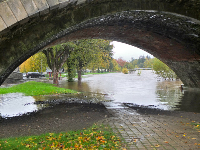
Flooding at Tweed Green, Peebles
After prolonged overnight rain, the Tweed has encroached onto Tweed Green on the north bank. Fortunately the flooding is not at present as extensive as the record flood of 30th December 2015 shown in NT2540 : Flooding across Tweed Green, Peebles (2).
See also NT2540 : Path to Tweed Green, Peebles for a similar view under normal conditions.
See also NT2540 : Path to Tweed Green, Peebles for a similar view under normal conditions.
 Map © Crown Copyright")
TIP: Click the map for more Large scale mapping
- Grid Square
- NT2540, 1180 images (more nearby 🔍)
- Photographer
- Jim Barton (more nearby)
- Date Taken
- Thursday, 28 October, 2021 (more nearby)
- Submitted
- Thursday, 28 October, 2021
- Subject Location
-
OSGB36:
 NT 2515 4031 [10m precision]
WGS84: 55:39.0321N 3:11.4592W - Camera Location
-
OSGB36: NT 2503 4033
- View Direction
- EAST (about 90 degrees)