2021
SK0964 : Access Lane leading to Folds End Farm
taken 2 years ago, near to Longnor, Staffordshire, England
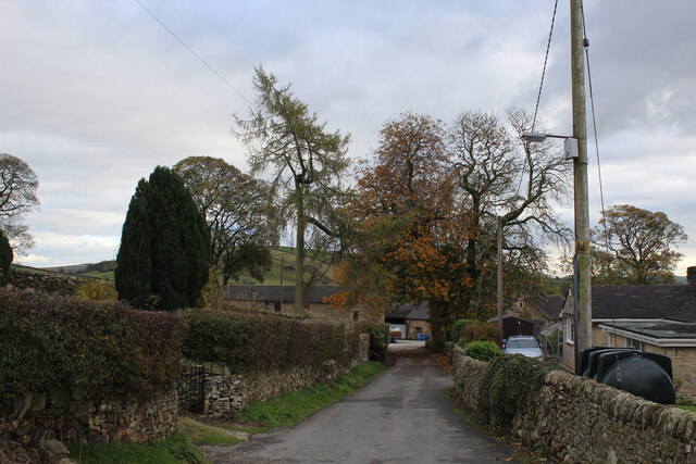
Access Lane leading to Folds End Farm
Adopted by the Manifold Trail long distance footpath, this access lane heads off the High Street in Longnor towards Folds End Farm
Manifold Trail
Long Distance Footpath that starts at Manifold Head near the village of Flash, following the river downstream through Longnor, Brund, Hulme End, Ilam to its confluence with the River Dove - a distance of 23 miles.
 Map © Crown Copyright")
TIP: Click the map for more Large scale mapping
- Grid Square
- SK0964, 37 images (more nearby 🔍)
- Photographer
- Chris Heaton (more nearby)
- Date Taken
- Wednesday, 3 November, 2021 (more nearby)
- Submitted
- Saturday, 13 November, 2021
- Subject Location
-
OSGB36:
 SK 0904 6487 [10m precision]
WGS84: 53:10.8513N 1:51.9714W - Camera Location
-
OSGB36: SK 0901 6490
- View Direction
- Southeast (about 135 degrees)