2021
SH9168 : Peaty pond on Moel Unben
taken 2 years ago, near to Llanfair Talhaiarn, Conwy, Wales
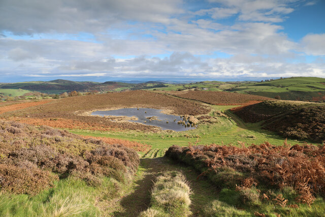
Peaty pond on Moel Unben
The heather moorland on top of Moel Unben (and extending a kilometre to its NNE) is not blessed with any public rights of way, but has a considerable network of tracks on which we all have a right to roam as the area is CROW Access Land. Although it is quite clear that the tracks are used by agricultural vehicles, signs a short distance from the public road (one of which is on a post where one track heads off between bracken towards the right of the photo) remind visitors that there is no public access for vehicles and that at least part of the area is a Site of Special Scientific Interest.
 Map © Crown Copyright")
TIP: Click the map for more Large scale mapping
- Grid Square
- SH9168, 8 images (more nearby 🔍)
- Photographer
- Andy Waddington (more nearby)
- Date Taken
- Tuesday, 9 November, 2021 (more nearby)
- Submitted
- Tuesday, 16 November, 2021
- Subject Location
-
OSGB36:
 SH 9129 6843 [10m precision]
WGS84: 53:12.1076N 3:37.7363W - Camera Location
-
OSGB36: SH 9120 6838
- View Direction
- East-northeast (about 67 degrees)