2012
SK1114 : Trent and Mersey Canal at Kings Bromley Wharf
taken 12 years ago, near to Rileyhill, Staffordshire, England
Trent and Mersey Canal at Kings Bromley Wharf
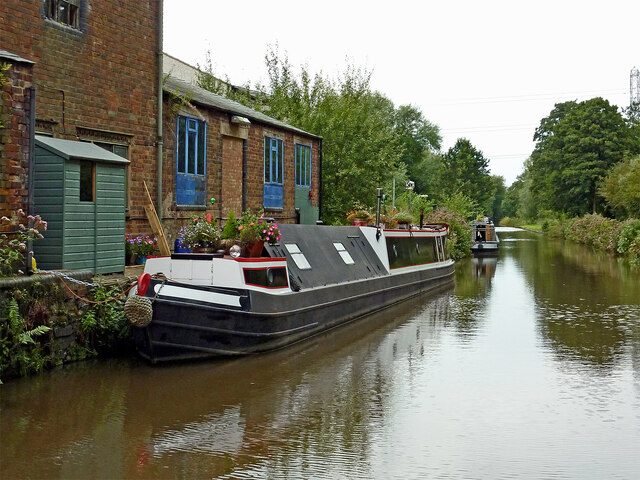
This is the Trent and Mersey Canal, looking north-west towards Rugeley and Great Haywood Junction from near Lichfield Road Bridge, No 54.
A creamery was built alongside the Trent and Mersey Canal at Bromley Hayes by the Trent Valley Dairy and Produce Co Ltd in 1885, but was short lived, becoming bankrupt and closing in 1892. By 1896 the site was being operated by Edwards Creameries, and was later bought by United Dairies. It operated until the 1930s. Link
The buildings are now used by various small businesses.
Note: King's Bromley is commonly spelt without its apostrophe.
Trent and Mersey Canal
The Trent and Mersey Canal is 93·5 miles in length from Derwent Mouth to Preston Brook. The first cut was made by Josiah Wedgwood in July 1766 at Middleport (Stoke-on-Trent). The eastern section between Derwent Mouth and Shugborough (the junction with the Staffordshire and Worcestershire Canal) was already operational by 1770 and the whole canal through to Preston Brook, where it linked with the Bridgewater Canal was open for business by 1777. James Brindley was the engineer until his death in 1772. There are seventy-six locks en route to raise and lower the water level where hills impede the course. There are four tunnels, including the famous Harecastle Tunnel near Stoke-on-Trent.
 Map © Crown Copyright")
TIP: Click the map for more Large scale mapping
- Grid Square
- SK1114, 59 images (more nearby 🔍)
- Photographer
- Roger D Kidd (more nearby)
- Date Taken
- Friday, 31 August, 2012 (more nearby)
- Submitted
- Saturday, 27 November, 2021
- Subject Location
-
OSGB36:
 SK 1153 1482 [10m precision]
WGS84: 52:43.8539N 1:49.8418W - Camera Location
-
OSGB36: SK 1157 1478
- View Direction
- Northwest (about 315 degrees)