2021
NT3236 : Leaning tree, Innerleithen cyclepath
taken 2 years ago, near to Innerleithen, Scottish Borders, Scotland
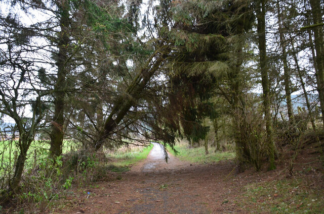
Leaning tree, Innerleithen cyclepath
A tree partly dislodged by Storm Arwen (26-27 November) on the former railway route between Innerleithen and Peebles. On the whole this area of the Borders has not been affected so badly as have communities closer to the east coast, though power was cut in nearby Thornielee for a few days, and trees have been windthrown in parts of the local forestry plantations. Mountain bike trails are currently closed while the damage is assessed.
 Map © Crown Copyright")
TIP: Click the map for more Large scale mapping
- Grid Square
- NT3236, 168 images (more nearby 🔍)
- Photographer
- Jim Barton (more nearby)
- Date Taken
- Friday, 3 December, 2021 (more nearby)
- Submitted
- Sunday, 5 December, 2021
- Subject Location
-
OSGB36:
 NT 3268 3619 [10m precision]
WGS84: 55:36.8776N 3:4.2206W - Camera Location
-
OSGB36: NT 3265 3620
- View Direction
- East-southeast (about 112 degrees)